Farmers/producers have the opportunity to impact broadband coverage in rural America far into the future. It is no secret the use of technology is growing in the agricultural industry through the use of digital ag applications. Farms need broadband connectivity as they meet the food and fiber needs of the world.
By farmers/producers taking time to check and challenge the FCC Broadband Map as it relates to serviceable broadband locations, they can demonstrate the tremendous need for funding for broadband infrastructure. Every structure that can use connectivity to support your farming operation needs to be on the FCC Broadband Map. For example, farm shop offices, poultry houses, or swine facilities need to be labeled as serviceable business locations because there is technology available for those facilities that require internet connections. Another example is grain bins. Grain bins need to appear on the map as serviceable business locations for the same reason. Technology applications will help farmers/producers manage their grain storage by monitoring moisture levels and by controlling the drying fans.
Below are some examples where location challenges need to be submitted.
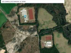
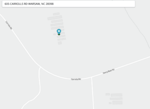
In the first two images below, the confinement operation at the top of the image is designated as a serviceable location. However, the operation at the bottom is not. The owner of the operation needs to make a Location Challenge to include the operation at the bottom of the image as a serviceable business location. This is a good place to point out that square or rectangle structures are more likely to show up as “footprints” when the satellite view is turned off. Grain bins (round) structures do not usually show up, so you simply click on the map where the footprint should be or leave the satellite view on for the challenge. These should be entered as “business” types when asked that question.


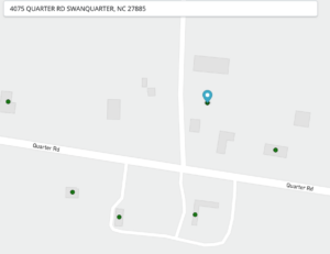
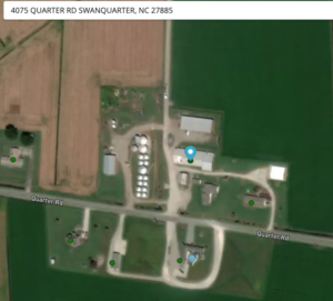
In the following two images, the operator needs to make a location challenge to include the grain bins as a serviceable business location. They did not show up as a footprint, so clicking where the grain bins appear on the satellite image will be the best way to make this challenge.


For funds to be allocated for installing broadband infrastructure in rural areas, the need must be demonstrated. Including farm offices, poultry and swine facilities, and grain storage structures, demonstrates the technology needs in modern farming. Digital agriculture is here, these mapping efforts will help ensure the connectivity is available to use the new technologies.
Here is the link where you can check your data: FCC Broadband Map.
Here is the link to some resources to help promote the importance of this opportunity.
Here are some links to some How To Videos explaining the steps.

Comments (0)